Southeast
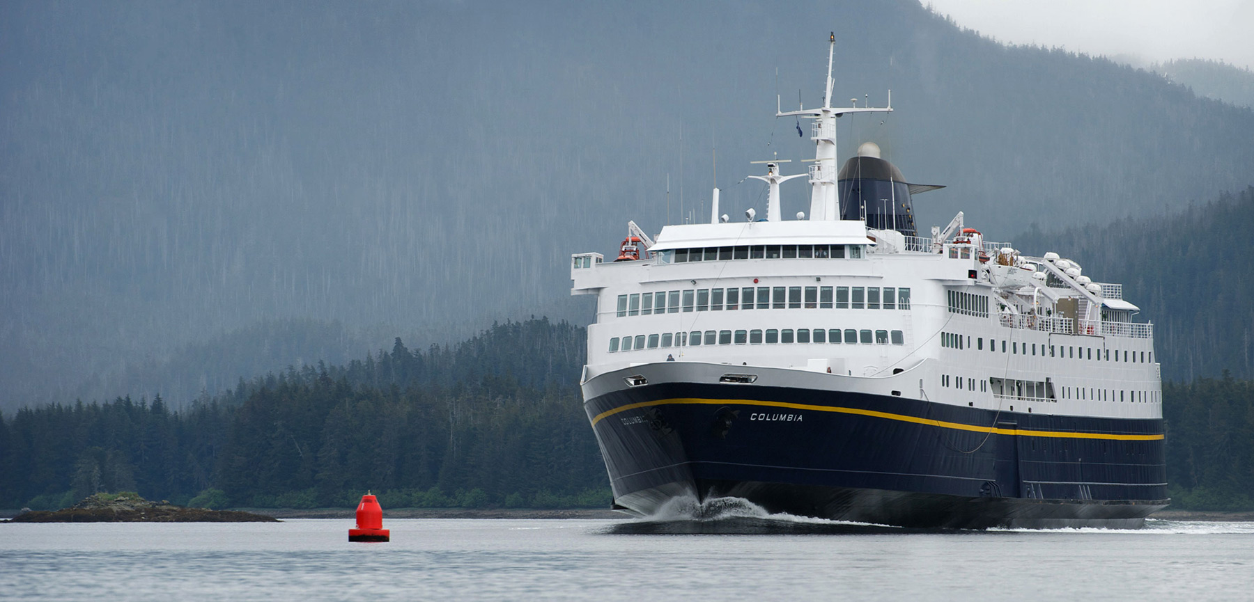
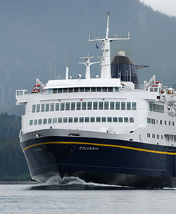
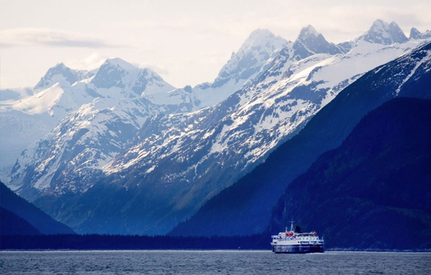
The MV Columbia, which runs between Bellingham, WA and Skagway, started monitoring for ocean acidification in 2017.
What We Know
In Southeast Alaska, climate change-related factors are accelerating the rate of ocean acidification. Melting glaciers in the Gulf of Alaska add freshwater that drains directly into the ocean, diluting the seawater and reducing the calcium carbonate minerals available for organisms to build their shells.
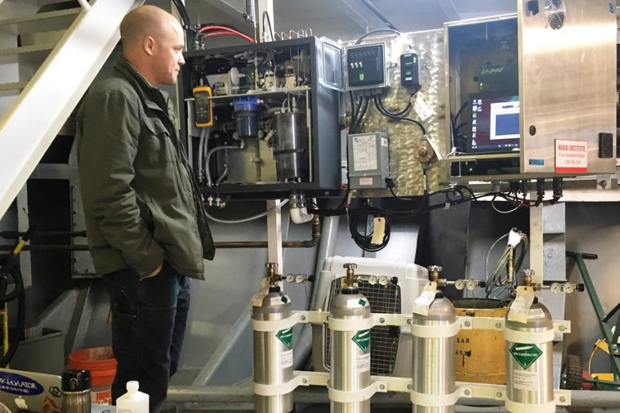
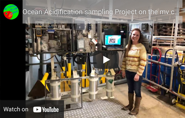
In 2017, a vessel of the Alaska Marine Highway Service named Columbia was instrumented with sensors to gather information on ocean acidification along the Inside Passage between Bellingham, WA and Skagway, AK. Over the next two years, over 244,000 surface (~2m) seawater temperature, salinity, oxygen, and carbon dioxide measurements were made by the M/V Columbia over the course of 135 north and south-bound transits. The data collected were used to calculate two important metrics: acidity (pH) and aragonite saturation state (written Ωarag). pH provides us with a measure of how acidic seawater is, while Ωarag represents how corrosive the water is to shell-building organisms: values of Ωarag < 1 are generally considered harmful to shell building organisms. The goal of this effort was to (1) gain a better understanding of the environmental and human-caused drivers of ocean acidification along the coast, (2) investigate seasonal variability of carbon chemistry conditions across the region and ecosystem change to date, and (3) explore the ecosystem’s resilience to a future atmospheric CO2 that corresponds with a 1.5 C warmer world.
Southeast Alaska Regional Profile
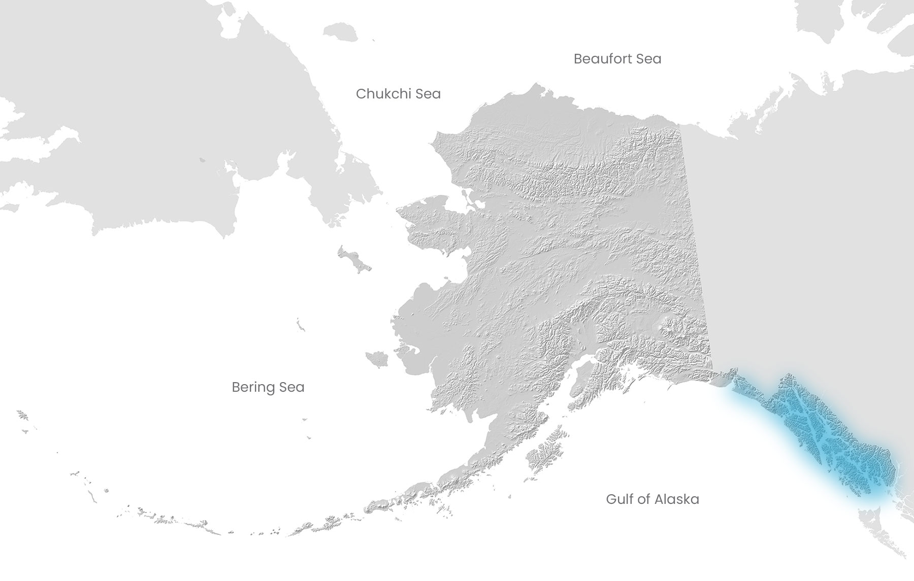
Southeast Alaska consists of the waters between Cape Suckling on the north and Dixon Entrance on the south. These are the traditional waters of the Tlingit, Haida, Tsmishian and Eyak indigenous peoples. Southeast currently supports a number of commercial and subsistence fisheries, including: salmon, halibut, herring, black cod, golden and red king crab, Dungeness crab, Tanner crab, ling cod, rockfish, pandalid shrimp and other shellfish.
Photo Gallery
↓Click to enlarge↓
What we learned from the M/V Columbia
In general:
- Carbon chemistry conditions varied a lot across the 1600 km transect, and across seasons.
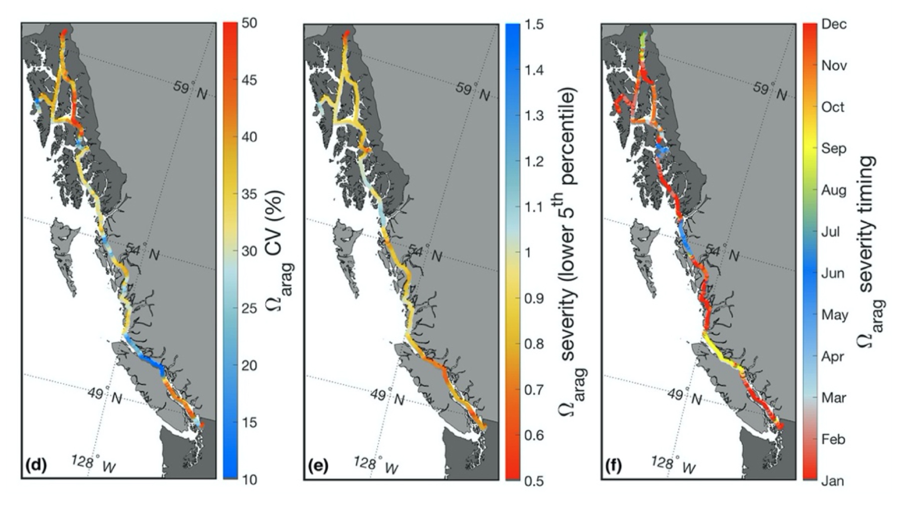
- In winter, waters were corrosive (Ωarag < 1) and more acidic (low pH value) in all regions that lacked a direct connection to the open continental shelf, which describes much of the Alexander Archipelago.
- Acidity and corrosive conditions were seen all year in zones where the tides regularly mix waters, such as Wrangell Narrows.
- Corrosive conditions were also seen in areas that receive significant glacial melt in the summer, with Lynn Canal exhibiting the most severe conditions along the 1600 km Columbia transit.
Extremes in variability and severity:
- Acidity and corrosivity was highly variable in the Alexander Archipelago relative to other areas along the Inside Passage. This was especially true for northern Southeast Alaska (Chatham Strait, Frederick Sound, Stevens Passage, Peril Strait, and Lynn Canal).
- Contrasting with these highly variable areas, Sergius Narrows and Wrangell Pass had low variability owing to the influence of persistent tidal mixing.
- In terms of severity, Lynn Canal and Wrangell Narrows were highly corrosive (severe Ωarag values) but less acidic (less severe pH).
- Areas exposed to the open continental shelf, such as Dixon Entrance and near Sitka, generally had less severe and variable acidity and corrosivity (pH and Ωarag) compared to confined waters along the Inside Passage.
Timing of severe conditions:
- The majority of Southeast Alaska waters experienced severe acidity and corrosivity between November and February.
- In the area near the mouth of the Stikine River, the most severely corrosive conditions occurred in June, likely in association with the snow-melt freshet (a freshet is a rush of fresh water flowing into the ocean).
- Waters were most corrosive in Lynn Canal in August, when changes in ocean chemistry that are potentially harmful to shell builders are caused by the peak input of glacial melt. Adding insult to injury, the most acidic conditions in Lynn Canal occurred in November owing to storm-induced mixing of the water column.
What might the future look like:
- Waters will become more acidic as pH decreases in winter, especially in semi-enclosed waterways with little connection to the open ocean, like much of the Alexander Archipelago.
- In contrast to pH, Ωarag will decrease more in the summer months – meaning waters will be more corrosive to shell builders – throughout much of Southeast Alaska. Possible exceptions are tidally mixed areas like the Wrangell Narrows.
- The pace of acidification in Southeast is accelerating. The magnitude of the change we’ve seen over the past 250 years is expected to happen again in the next 15 years.
Recent Studies
Marine CO2 system variability determined from an Alaskan Ferry: Evans et al 2021
- From 2017, the Alaska Marine Highway System M/V Columbia has served as a platform for surface underway data collection while conducting twice weekly ~1600-km transits between Bellingham, Washington and Skagway, Alaska.
- This 2-year dataset allowed for the assessment of marine CO2 system patterns along the Inside Passage. Surface water pH and aragonite saturation state (Ωarag) were determined using the pCO2 data with alkalinity from a regional salinity-based relationship, which was evaluated with discrete seawater samples and underway pH measurements.
Results
- Low pH and corrosive (Ωarag < 1) Ωarag conditions were seen during winter and in persistent tidal mixing zones;
- Corrosive Ωarag values were also seen in areas that receive significant glacial melt in summer;
- Time-of-detection (the time it takes to tease out the contribution of anthropogenic acidification from natural variability) was computed. Results revealed that tidal mixing zones may be sentinel observing sites with relatively short time spans of observation needed to capture secular trends in seawater pCO2 equivalent to the contemporary atmospheric CO2 increase.
- Anthropogenic CO2 was estimated and showed notable time and space variability. We theoretically considered the change in hydrogen ion concentration ([H+]), pH, and Ωarag over the industrial era and to an atmospheric pCO2 level consistent with a 1.5°C warmer climate and revealed greater changes in [H+] and pH in winter as opposed to larger Ωarag change in summer.
- In addition, the contemporary acidification signal everywhere along the Inside Passage exceeded the global average, with Johnstone Strait and the Salish Sea standing out as potential bellwethers for biological OA impacts.
- In theory, roughly half the acidification signal experienced thus far over the industrial era may be expected over the coming 15 years with an atmospheric CO2 trajectory that continues to be shaped by fossil-fuel development.
Implications
Variation in the timing of severe conditions may have implications for marine organisms and fisheries, especially if severe conditions coincide with more sensitive life stages of vulnerable species. Additionally, differences in the season during which maximum changes in seawater acidity versus seawater corrosivity (pH vs Ωarag) occur points to the need for careful consideration of the specific parameter an organism may be most sensitive to. This is especially important for communities that grow and harvest shellfish.
The variability and severity of carbon chemistry conditions may also impact how organisms adapt as conditions intensify. For example, organisms in Wrangell Narrows experience a sustained corrosive and moderately stable low pH environment; whereas in Lynn Canal, organisms are subjected to large swings in marine CO2 system parameters over the year. Some research suggests that long term exposure to variable conditions may improve physiological tolerance to ocean acidification. On the other hand, in Lynn Canal, organisms are subjected to large swings in marine parameters over the year. Research indicates that organisms living in persistently acidifying environments might be more locally adapted.
The wide variability in conditions across seasons and across Southeast Alaska, as well as the predicted trends in ocean conditions, suggests that careful local planning is necessary to support communities in vulnerable regions.
Researchers
Stories
Mar 2020
Ocean Acidification International Coordination Center

