Ship-Based Stations
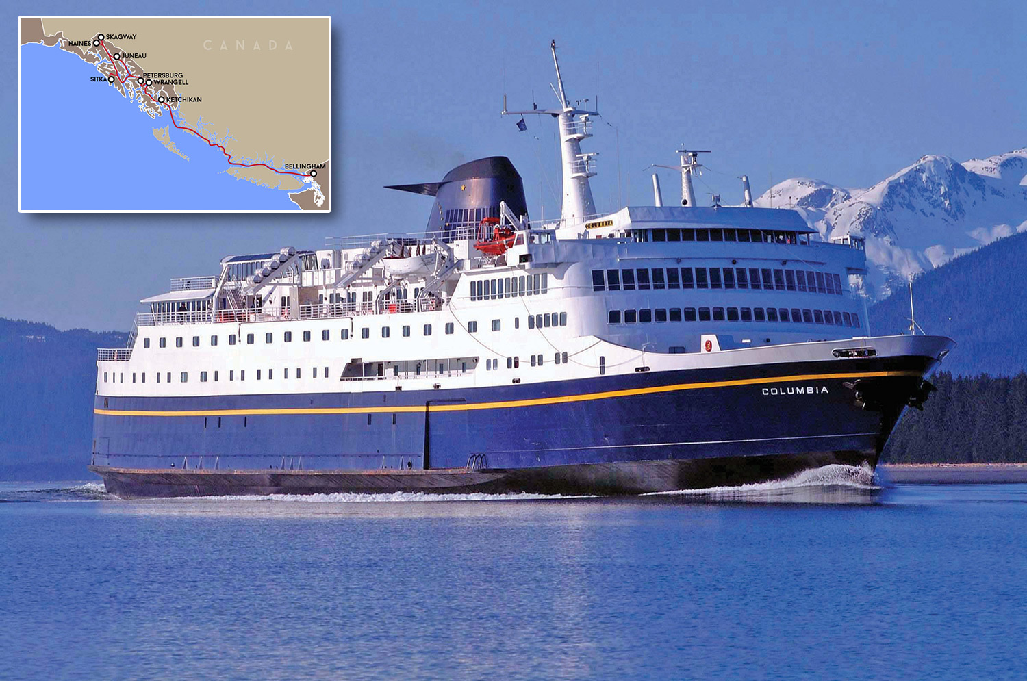
Alaska Marine Highway Ferry: Columbia
Location: Continuous monitoring between Bellingham, WA to Skagway, AK (a round trip of 1,854 miles per week)
Timeline: Monitoring ran November 2017 – September 2019 until the Columbia was taken out of service. Samples were recorded every 3 minutes. The Columbia is expected to go back into service in 2023.
Instrumentation: Temperature, dissolved oxygen, salinity, and CO2.
Description: The Columbia data collection is part of an international effort that began in 2014 to understand the impact of OA along the British Columbia and Alaska coasts. More on the ferry CO2 project.
Lead Investigator: Wiley Evans, Hakai Institute
Partners: The Hakai Institute, Alaska Coastal Rainforest Center at the University of Alaska Southeast, the Alaska Ocean Observing System, NOAA Pacific Marine Environmental Laboratory, and the Alaska Department of Transportation and Public Facilities
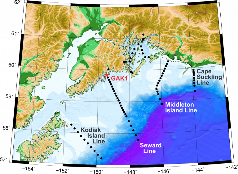
The Seward Line
Location: OA monitoring is currently taking place along the Seward and Kodiak Lines, and in Prince William Sound. The Seward Line is a transect of oceanographic survey stations that begins at the GAK1 mooring at the mouth of Resurrection Bay in the Gulf of Alaska (59°50.7’N, 149°28.0’W) and continues south across the Gulf of Alaska to past the outer edge of the continental shelf (58°5.9’N, 147° W). The Kodiak Line starts south of Kodiak (58°14.7’N 151°35.4’W) and ends off the shelf (57°12.27’N 149°43.17’W).
Timeline: From 2008-2017, sampling for OA was conducted along the Seward Line and in Prince William Sound twice per year in May and September. Starting in 2018, sampling has been conducted three times a year (May, July and September) along the Seward and Kodiak Lines and within Prince William Sound.
Instrumentation: Shipboard Niskin bottle grabs
Description: High quality water sample measurements for dissolved inorganic carbon and total alkalinity, and starting in 2018 also pH, are collected along the Seward and Kodiak Lines, and are allowing researchers to empirically derive carbonate parameters to get a better understanding of the natural spatial and temporal variability and functioning of the system. This data can also be used to evaluate biogeochemical models and create local risk maps. More on the Seward Line.
Lead Investigator: Claudine Hauri, University of Alaska Fairbanks
Collaborator: Russ Hopcroft, University of Alaska Fairbanks
Funding source: During 2008-2017 supported by AOOS and NSF, with additional logistical support from NPRB, Gulf Watch and UAF. During 2018-2022 supported by the Gulf of Alaska LTER. For 2022 and onward, supported by EVOSTC.
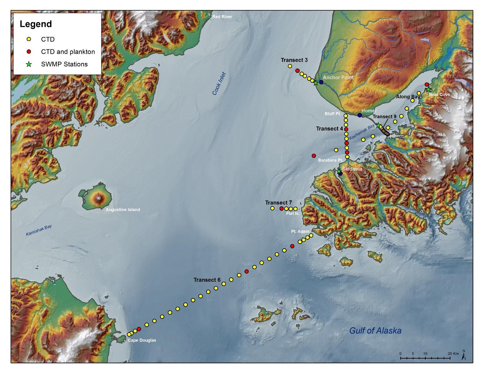
Kachemak Bay/Lower Cook Inlet Sampling
Location: 5 transects in lower Cook Inlet and Kachemak Bay (60.056, -154.365; 60.02, -150.9; 58.573, -154.349; 58.539, -151.033)
Timeline: Began in 2011; ongoing.
- Four lower Cook Inlet and outer Kachemak Bay transects (12 marine plankton and water stations) sampled quarterly
- One inner Kachemak Bay Transect (10 CTD stations and 3 marine plankton and OA monitoring sampling stations) sampled monthly
Instrumentation: Water samples collected at the surface and collected approximately 5m from the ocean bottom. In 2012-2013, samples were collected under a grant from AOOS to KBL and processed by UAF. In 2016, samples are collected by KBNERR and sent to the Alutiiq Pride Marine Institute for analysis.
Description: Ocean acidification was identified by local and regional stakeholders as an important issue in south central Alaska for subsistence & recreational food sources. Local stakeholders were also concerned that we do not have baseline information to help inform how ocean acidification will transform the local near shore ecology of the region (KBNERR Bivalve Proceedings 2014). The complexity of ocean chemistry in estuaries has led to this important habitat being omitted, thus far, from strategies developed for monitoring ocean acidification in Alaska. The KBNERR has a long-term monitoring program that can support and help direct additional monitoring and research into the complex nature of ocean acidification in estuary habitats in south-central Alaska. Through our existing programs and partnerships, we plan to grow this area of expertise for our region on a local, regional, national, and international scale.
Lead Investigators: Angie Doroff, Kachemak Bay Research Reserve; Kris Holderied, NOAA Kasitsna Bay Lab
Funding Source: AOOS 2012-2013, EVOSTC 2012-2016 for logistical support, Alutiiq Pride (BIA grant) for sample analysis in 2016.


