Moored Sensors
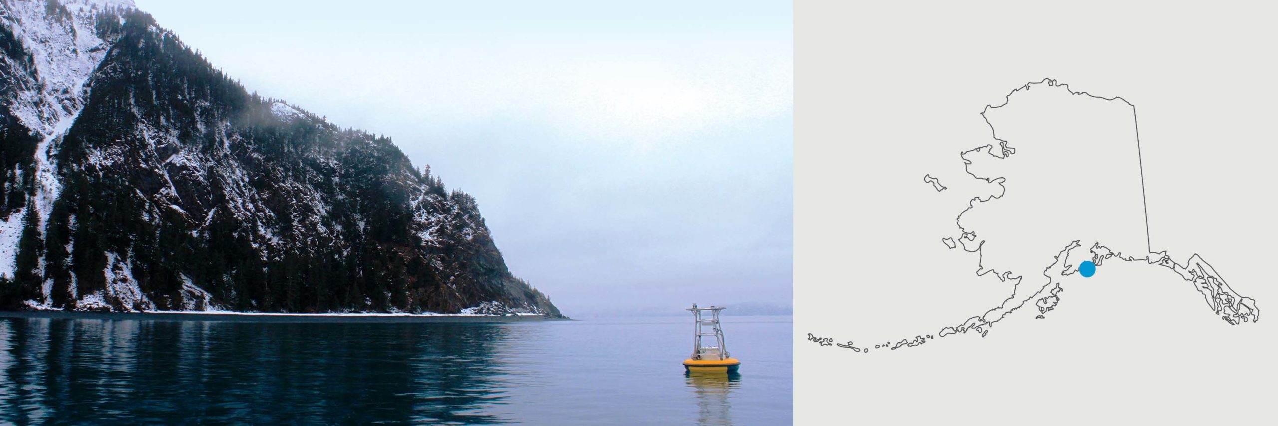
GAKOA Mooring
Location: Mouth of Resurrection Bay near Seward (59.91, -149.35). Note: GAKOA is a short distance from the nearby GAK1 mooring; these are two separate moorings
Timeline: 2011-present, measurements every 180 minutes
Instrumentation:
- Surface MAPCO2, Satlantic SeaFET pH, and SBE SEACAT CTD (SBE 16+) reporting near real-time (once a day)
- Subsurface pCO2 and pH sensors near bottom, 265m water depth (SAMI CO2, SAMI pH, and SBE SEACAT)
Description
Interannual variations in temperature and salinity on the northern Gulf of Alaska (GAK) shelf reflect environmental changes that affect this marine ecosystem. Quantifying and understanding this variability requires long time series such as the 32-year record at hydrographic station GAK 1 near Seward. The GAK 1 time series appear to be a reliable proxy for the freshwater content, and the geostrophic, baroclinic component of the mass and freshwater transport in the Alaska Coastal Current along the Cape Fairfield Line. Variability in the marine environment, as reflected in ocean temperatures and salinities, and the shelf circulation, need to be quantified to understand the structure of, and changes in, the northern Gulf of Alaska marine ecosystem. The GAKOA project continues the GAK time series with a surface mooring containing a MAPCO2 system and a surface seawater pH sensor. By measuring pH in addition to pCO2, we are able to more accurately and precisely study the changes associated with ocean acidification. View the data.
Principal Investigator: UAF Ocean Acidification Research Center (OARC)
Funding Source: State of Alaska, NSF, NOAA, AOOS, NPRB, UAF-OARC
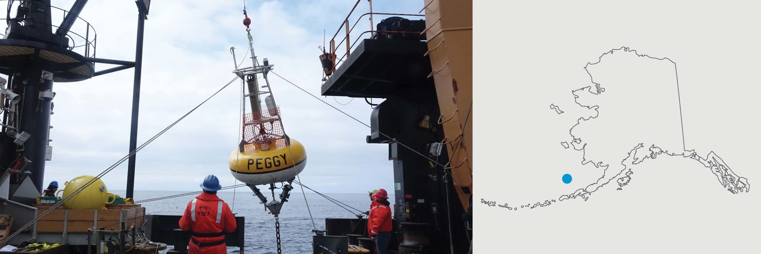
M2 Mooring
Location: Southeastern Bering Sea (56.87N, -164.06W)
Timeline: 2011-present, measurements every 180 minutes
Instrumentation:
- Surface mooring installed for summer months (May – Sept). Includes surface MAPCO2, Satlantic SeaFET pH, and SBE SEACAT CTD (SBE 16+), reporting daily in near real-time.
- Full year subsurface pCO2 and pH sensors near bottom, 67m water depth (SAMI CO2, SeaFET pH, and SBE SEACAT).
Description
Interannual variations in the partial pressure in CO2 (pCO2) and pH on the southeastern Bering Sea shelf reflect environmental changes that affect this marine ecosystem. It is critical to quantifying and understanding this variability, particularly in a region where a vulnerable fishery exists. The M2 OA mooring will measure the variability in the region, as reflected in ocean temperatures and salinities, and the shelf circulation, to quantify and understand the structure of, and changes in, the southeastern Bering Sea marine ecosystem. By measuring pCO2 and pH, we are able to more accurately and precisely study the changes associated with ocean acidification. View the data.
Principal Investigator: UAF Ocean Acidification Research Center (OARC)
Funding Source: State of Alaska, NSF, NOAA, AOOS, NPRB, UAF-OARC
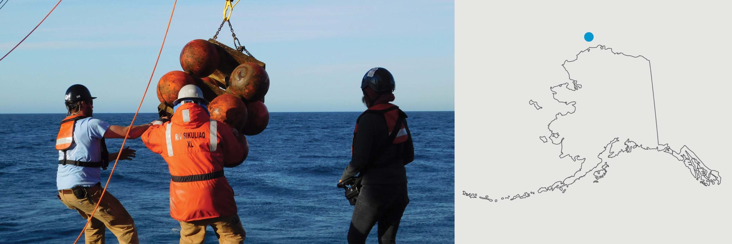
Chukchi Sea Mooring
Location: NE Chukchi shelf near 71.6N, 161.5W at the southern flank of Hanna Shoal
Timeline: OA sensors were deployed for the first time in summer 2016 and are redeployed annually. The first deployment of the observatory (without OA sensors) occurred in September 2014.
Instrumentation: The Observatory consists of three closely located moorings. Contros HydroC and Sea-Bird SeapHOx instrumnts are being used to measure pCO2, pH, oxygen, temperature and salinity at 35 m depth. See the full list of other biological, physical and chemical instrumentation.
Description
Integrating pCO2 and pH measurements with the other measured parameters will aid in the understanding of the controlling forces that mediate ocean acidification and carbon fluxes in the Chukchi Sea throughout the year, including the under sampled and poorly understood seasons when sea ice inhibits ship-based samples. Along with ocean acidification, the Arctic is undergoing unprecedented climate induced transformation that include warming temperatures, extensive sea-ice losses, increases in storm frequency/magnitude, enhanced wind-driven mixing, and increasing inputs of terrestrial organic matter. Our ecosystem observatory will help us capture these changes and their effects on the ecosystem.
Principal Investigators: University of Alaska Fairbanks – Seth Danielson, Claudine Hauri, Andrew McDonnell, Russ Hopcroft, and Peter Winsor; Catherine Lalande (Université Laval); Kate Stafford (University of Washington).
Funding Source: This project is supported by a multi-institutional consortium that includes the Alaska Ocean Observing System, the North Pacific Research Board, Olgoonik-Fairweather, Université Laval, the University of Washington and the University of Alaska Fairbanks.
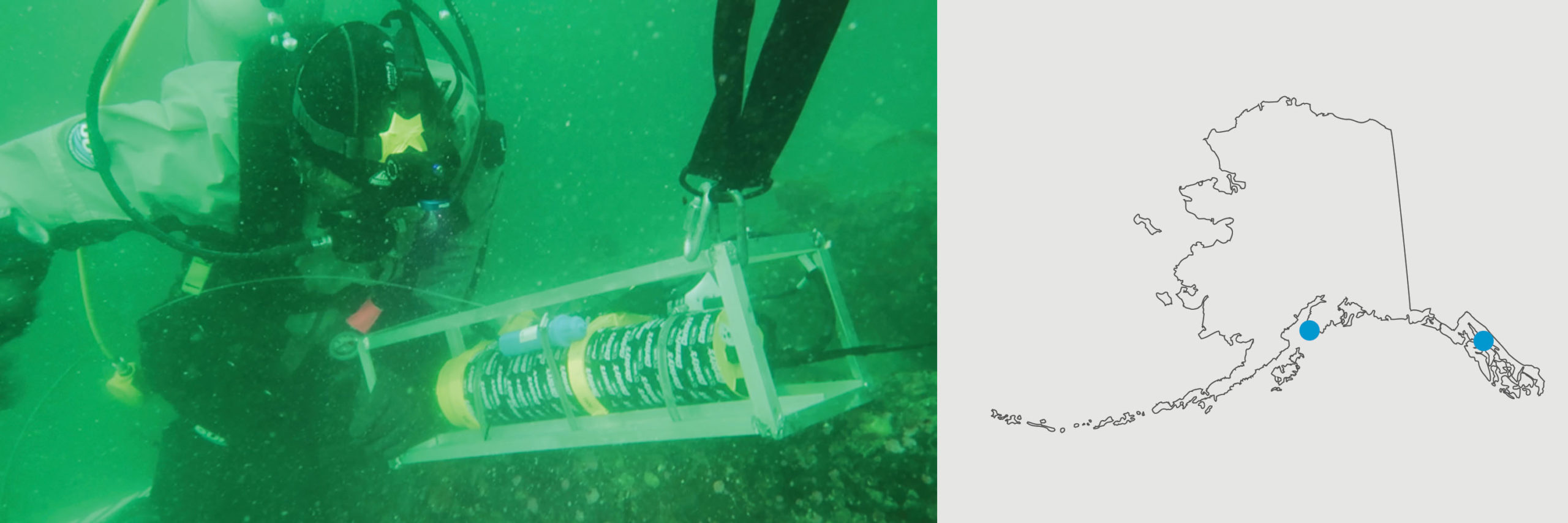
Nearshore Mooring Networks in Kachemak Bay and Juneau
Locations:
Lat long of Kachemak Bay pH sensors
- Homer: 59°36’07.4″N 151°24’31.8″W
- Seldovia: 59°26’26.9″N 151°43’15.4″W
- Kasitsna Bay Lab: 59°28’07.2″N 151°33’10.3″W
- Jakalof Bay: 59°27’57.1″N 151°32’09.4″W
- Bear Cove: 59°43’32.8″N 151°03’21.0″W
Lat long of Juneau pH sensors
- Otter Run: 58° 20′ 52.3176″ N 134° 39′ 6.3324″W
- Lena point: 58° 23′ 27.402″ N 134° 46′ 33.5136″ W
- Gastineau Channel: 58° 13′ 40.1664″ N 134° 16′ 1.2828″ W
Timeline: Kachemak Bay sensors Oct 2017-present. Juneau sensors Aug 2019-present. Measurements every 180 minutes.
Description
Nearshore ecosystems help to protect the coastline and provide important habitat for marine animals. Because these ecosystems are highly dynamic and complex, it has been challenging to accurately monitor changes in ocean chemistry in coastal waters, especially in Alaska. The goal of these sensor networks is to characterize baseline high-frequency pH dynamics in Kachemak Bay (Homer, AK) and Lynn Canal (Juneau, AK). These communities are vital coastal areas for commercial, recreational and substance activities. With few baseline ocean pH records in place, it is difficult to determine the human-caused and natural influences on ocean pH variability. Measuring OA is increasingly important to aid our understanding of how marine ecosystems will respond to global ocean change.
Principal Investigators: Amanda Kelley UAF
Funding Sources: Kachemak Bay array: BOEM, NSF; Juneau array: NSF
MARES Beaufort Sea Mooring
Location: Beaufort Sea Shelf (69 46.2346 N, 139 15.2855 W), west of the Mackenzie River Delta.
Timeline: 2016-2018, measurements every 180 minutes
Instrumentation: OA sensors are deployed on two moorings in a network that observes across-shelf structure of many variables such as temperature, salinity, chlorophyll, oxygen, carbon dioxide (Sunburst Sensors SAMI CO2), and current speed and direction.
Description
These moorings are part of the Marine Arctic Ecosystems Study (MARES). This study is observing the Arctic marine ecosystem along the Beaufort Sea Shelf from Barrow, AK to the Mackenzie River delta in the Yukon Territory, Canada. Understanding the relationships of the physical, biological, chemical, and human systems near the Mackenzie River in the Arctic Region will help understand linkages between oceanic processes and river discharge. The moored OA sensors are one part of a large sampling program including ships, drones, satellites, and models.
Principal Investigators: This international, interagency program is led by Stantec, which pairs federal agencies, academia, industry, and non-governmental organizations. The OA component is led by the Ocean Acidification Research Center (University of Alaska Fairbanks).
Funding Source: Bureau of Ocean and Energy Management
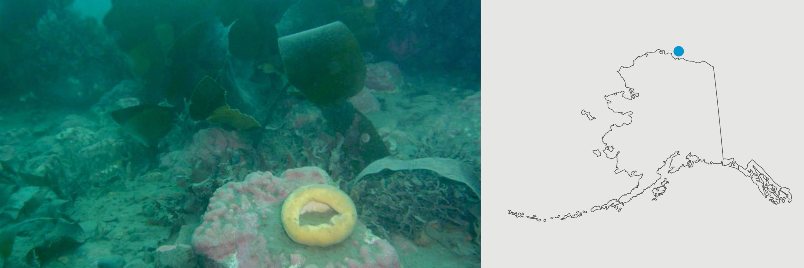
Stefansson Sound Mooring
Location: Stefansson Sound, Alaska (sites E-1 and DS-11); 70°23’ N; 147°50’ W
Timeline: Deployed July 2016, taking hourly measurements
Instrumentation: Satlantic SeapHOx (Ocean CT(D)-pH-DO) and SBE SEACAT CTD (SBE 16+) deployed remotely by divers in 5-7 m water depths
Description
Seasonal and spatial variations in temperature and salinity within the Boulder Patch kelp community in Stefansson Sound reflect environmental changes that affect this marine ecosystem. Quantifying and understanding this variability requires continuous measurements of these parameters at multiple sites. Data from these sensors will allow us to understand the variation in seawater pH in relation to freshwater run-off from the Sagavanirktok River. Variability in the marine environment, as reflected in ocean temperatures, salinities, and pH need to be quantified to understand the structure of, and changes in, the Boulder Patch marine ecosystem. By measuring pH in addition to salinity and temperature, we are able to more accurately and precisely study the changes associated with the rich benthic community of this Arctic kelp community.
Principal Investigator: Ken Dunton (PI) and PhD Student Arley Muth, University of Texas
Funding Source: BOEM

