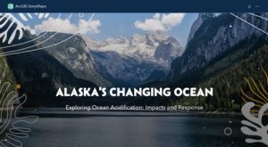
 A new storymap on ocean acidification in Alaska gives viewers an intro to the processes and implications of ocean acidification and ways that Alaskans are engaging on this topic. Using eye-catching imagery and clickable resources, this online tool is designed to help introduce ocean acidification to new audiences in an approachable way.
The storymap is part of a set of six regional maps across the U.S. put together through a partnership between the International OA Alliance, the Aquarium Conservation Partnership and NOAA’s Ocean Acidification Program in collaboration with the regional ocean acidification networks. The goal is to advance communications about climate-ocean changes occurring regionally in the U.S. by presenting localized information on unique impacts, responses, and calls to action taking shape across the country.
- Learn more about the collaborative project.
- Visit the entire storymap collection
Visit the Alaska Storymap
Desired and intended uses of the StoryMaps:
We hope that participating aquaria and marine leaning centers will share the StoryMaps as displays and exhibits. This could be accomplished by posting flyers, banners, interactive signs with scan codes or website addresses linking to the relevant StoryMap. Institutions could also use interactive touch screens to display and offer the StoryMap content to visitors. Scan codes and website addresses can also be posted on various flyers, pamphlets or collateral created for the project or affixed to associated materials that partner institutions are distributing.
Additionally, the collection of StoryMaps will be shared on project partner websites (OA Alliance, ACP, NOAA OAP) and we encourage partners to link and share the collection or relevant regional StoryMap on their own websites or social media platforms.